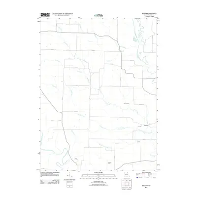
2012 Map of Benjamin
USGS Topo · Published 2012About this map
The North Fabius River and the winding Wyaconda River define the agricultural borders of this northeastern Missouri landscape in the early 21st century. The area is anchored by the small settlements of Benjamin and Derrahs, connected by a network of rural routes such as Co RD-405 and Co RD-421. The topography is shaped by an intricate drainage system including Little Sugar Creek, Rainbow Slough, and numerous branches named for early residents, such as Fretwell Branch and Ramsey Branch.
Find a feature on this map
42 named features on this map. Tap any name to fly to it.
Don’t see what you’re looking for? This feature index may not catch every label — zoom into the map to look around manually.
Map Details
Editions of this 2012 Benjamin Map
This is the sole edition of this map. No revisions or reprints were ever made.
Other maps of this area

1903 · Kahoka
USGS Topo · 1:125,000

1949 · Kahoka SE
USGS Topo · 1:24,000

1949 · St. Patrick
USGS Topo · 1:24,000

1950 · Saint Patrick
USGS Topo · 1:24,000

1950 · Kahoka SE
USGS Topo · 1:24,000

1950 · Neeper
USGS Topo · 1:24,000

1950 · La Grange
USGS Topo · 1:24,000

1950 · Benjamin
USGS Topo · 1:24,000

1950 · Williamstown
USGS Topo · 1:24,000

1950 · Canton
USGS Topo · 1:24,000