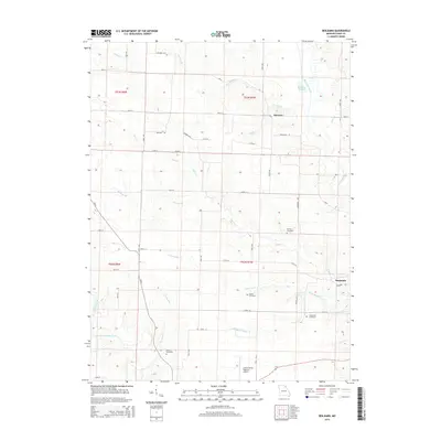
2015 Map of Benjamin
USGS Topo · Published 2015About this map
The Wyaconda River and the North Fabius River define the undulating landscape of this northern Missouri region, where the small community of Benjamin sits at a rural crossroads. The area is characterized by a dense network of creek branches, including Sugar Cr and Little Sugar Cr, which have carved numerous drainages through the township lands of T63N and T62N. This 2015 survey reveals a terrain deeply tied to its rural roots and genealogy, with several family-named burial grounds such as Henton Cemetery, Graves Cemetery, Patterson Cemetery, and Jarvis Cemetery scattered across the countryside.
Find a feature on this map
51 named features on this map. Tap any name to fly to it.
Don’t see what you’re looking for? This feature index may not catch every label — zoom into the map to look around manually.
Map Details
Editions of this 2015 Benjamin Map
This is the sole edition of this map. No revisions or reprints were ever made.
Other maps of this area

1903 · Kahoka
USGS Topo · 1:125,000

1949 · Kahoka SE
USGS Topo · 1:24,000

1949 · St. Patrick
USGS Topo · 1:24,000

1950 · Saint Patrick
USGS Topo · 1:24,000

1950 · Kahoka SE
USGS Topo · 1:24,000

1950 · Neeper
USGS Topo · 1:24,000

1950 · La Grange
USGS Topo · 1:24,000

1950 · Benjamin
USGS Topo · 1:24,000

1950 · Williamstown
USGS Topo · 1:24,000

1950 · Canton
USGS Topo · 1:24,000