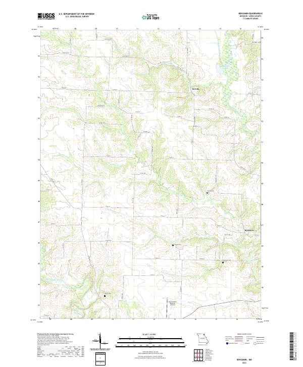
2021 Map of Benjamin
USGS Topo · Published 2021About this map
The Wyaconda River and the North Fabius River define the hydrography of this Lewis County landscape, where the settlement of Derrahs sits near the crossing of State Hwy E. The terrain is deeply etched by a network of drainage basins, including Sugar Cr, Little Sugar Cr, and the smaller S Br Little Sugar Cr. For those researching local lineages, several burial grounds are preserved across the sections, such as Henton Cem, Graves Cem, Jarvis Cem, and Patterson Cem. The southern edge of the map is notable for the Lewis County Regional Airport, contrasting the traditional agrarian land divisions marked by Hickory Ave and Rustic Ave with modern transportation infrastructure. Near the eastern boundary, the Rainbow Slough provides a look at the river bottom wetlands typical of this Missouri region.
Find a feature on this map
54 named features on this map. Tap any name to fly to it.
Don’t see what you’re looking for? This feature index may not catch every label — zoom into the map to look around manually.
Map Details
Editions of this 2021 Benjamin Map
This is the sole edition of this map. No revisions or reprints were ever made.
Other maps of this area

1903 · Kahoka
USGS Topo · 1:125,000

1949 · Kahoka SE
USGS Topo · 1:24,000

1949 · St. Patrick
USGS Topo · 1:24,000

1950 · Saint Patrick
USGS Topo · 1:24,000

1950 · Kahoka SE
USGS Topo · 1:24,000

1950 · Neeper
USGS Topo · 1:24,000

1950 · La Grange
USGS Topo · 1:24,000

1950 · Benjamin
USGS Topo · 1:24,000

1950 · Williamstown
USGS Topo · 1:24,000

1950 · Canton
USGS Topo · 1:24,000