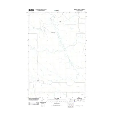
2011 Map of Bennett Lake NW
USGS Topo · Published 2011About this map
Rudolph Valley defines the southern portion of this Phillips County landscape, where the seasonal drainage of Rudolph Coulee meets the winding course of Alkali Creek. This 2011 survey captures a remote section of the Montana plains characterized by a complex network of ephemeral watercourses and coulees. The terrain is marked by significant hydrological features such as West Alkali Creek and Williams Coulee in the west, and Brown Coulee in the north. Man-made interventions in this arid environment are sparse, notable primarily by Slim Dam in the southwest. To the southeast, the landscape transitions into the distinctive Alkali Flat, illustrating the drainage patterns typical of this high plains region north of the Missouri River.
Find a feature on this map
9 named features on this map. Tap any name to fly to it.
Don’t see what you’re looking for? This feature index may not catch every label — zoom into the map to look around manually.
Map Details
Editions of this 2011 Bennett Lake NW Map
This is the sole edition of this map. No revisions or reprints were ever made.
Other maps of this area

1953 · Havre
USGS Topo · 1:250,000

1954 · Glasgow
USGS Topo · 1:250,000

1957 · Glasgow
USGS Topo · 1:250,000

1957 · Havre
USGS Topo · 1:250,000

1958 · Glasgow
USGS Topo · 1:250,000

1958 · Havre
USGS Topo · 1:250,000

1965 · Wagner
USGS Topo · 1:24,000

1965 · West Alkali Reservoir
USGS Topo · 1:24,000
1965 · Seymour Reservoir
USGS Topo · 1:24,000

1968 · Malta West
USGS Topo · 1:24,000