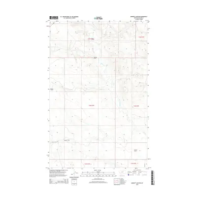
2014 Map of Bennett Lake NW
USGS Topo · Published 2014About this map
Alkali Creek and its various branches, including the westward-reaching W Alkali Cr, define the drainage patterns across this section of Phillips County. The landscape is characterized by a series of distinct topographic depressions and lowlands, most notably Rudolph Valley in the southern reaches and a collection of named coulees that segment the northern terrain. These features, such as Brown Coulee, Halfway Coulee, and Williams Coulee, indicate a highly eroded prairie environment. Human presence is sparse, marked primarily by the grid of the Public Land Survey System and local thoroughfares like Rudolph Valley Rd and Regina Rd. The map illustrates the intersection of several townships, including t28n r29e and t28n r30e, providing a clear view of the rural Montana land division as it stood in the early 21st century.
Find a feature on this map
17 named features on this map. Tap any name to fly to it.
Don’t see what you’re looking for? This feature index may not catch every label — zoom into the map to look around manually.
Map Details
Editions of this 2014 Bennett Lake NW Map
This is the sole edition of this map. No revisions or reprints were ever made.
Other maps of this area

1953 · Havre
USGS Topo · 1:250,000

1954 · Glasgow
USGS Topo · 1:250,000

1957 · Glasgow
USGS Topo · 1:250,000

1957 · Havre
USGS Topo · 1:250,000

1958 · Glasgow
USGS Topo · 1:250,000

1958 · Havre
USGS Topo · 1:250,000

1965 · Wagner
USGS Topo · 1:24,000

1965 · West Alkali Reservoir
USGS Topo · 1:24,000
1965 · Seymour Reservoir
USGS Topo · 1:24,000

1968 · Malta West
USGS Topo · 1:24,000