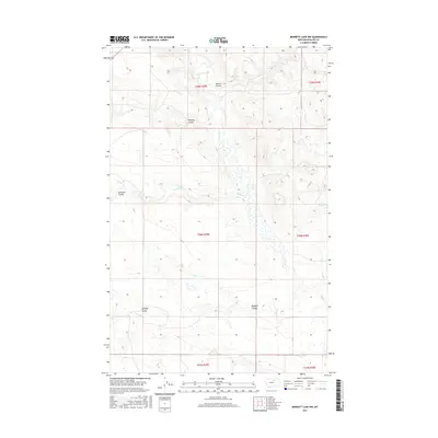
2017 Map of Bennett Lake NW
USGS Topo · Published 2017About this map
Rudolph Valley defines the southern landscape of this Phillips County terrain, where a network of coulees carves through the Montana plains. The drainage patterns of W Alkali Cr and Alkali Cr reveal the hydrological character of the region, flowing through a series of named depressions including Brown Coulee, Halfway Coulee, and Williams Coulee. This 2017 survey reflects the enduring cattle-country divisions of the Public Land Survey System, with township and range lines like t28n r29e and t29n r29e overlaying a sparsely settled expanse of wetlands and small basins. The presence of Rudolph Coulee in the southeast suggests a localized geographic naming tradition tied to the valley floor, providing a specific reference for those studying land use and topography in this corner of North Central Montana.
Find a feature on this map
13 named features on this map. Tap any name to fly to it.
Don’t see what you’re looking for? This feature index may not catch every label — zoom into the map to look around manually.
Map Details
Editions of this 2017 Bennett Lake NW Map
This is the sole edition of this map. No revisions or reprints were ever made.
Other maps of this area

1953 · Havre
USGS Topo · 1:250,000

1954 · Glasgow
USGS Topo · 1:250,000

1957 · Glasgow
USGS Topo · 1:250,000

1957 · Havre
USGS Topo · 1:250,000

1958 · Glasgow
USGS Topo · 1:250,000

1958 · Havre
USGS Topo · 1:250,000

1965 · Wagner
USGS Topo · 1:24,000

1965 · West Alkali Reservoir
USGS Topo · 1:24,000
1965 · Seymour Reservoir
USGS Topo · 1:24,000

1968 · Malta West
USGS Topo · 1:24,000