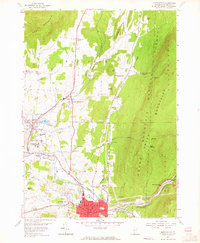
1954 Map of Bennington
USGS Topo · Published 1965About this map
Bennington serves as the focal point of this mid-century survey, showcasing a landscape where colonial-era heritage meets post-war institutional growth. The town's historical depth is anchored by Old Bennington and the iconic Battle Monument, while the presence of Bennington College and the State Soldiers Home illustrates the area's mid-century civic expansion. The topography is dominated by the steep rise of the Green Mountain National Forest to the east, contrasting with the developed valley floor where the Walloomsac River and Roaring Branch converge.
Find a feature on this map
70 named features on this map. Tap any name to fly to it.
Don’t see what you’re looking for? This feature index may not catch every label — zoom into the map to look around manually.
Map Details
Editions of this 1954 Bennington Map
3 editions found
Other maps of this area

1894 · Equinox
USGS Topo · 1:62,500

1895 · Cambridge
USGS Topo · 1:62,500

1896 · Equinox
USGS Topo · 1:62,500

1897 · Hoosick
USGS Topo · 1:62,500

1898 · Cambridge
USGS Topo · 1:62,500

1898 · Bennington
USGS Topo · 1:62,500

1900 · Taconic
USGS Topo · 1:125,000

1900 · Equinox
USGS Topo · 1:62,500

1901 · Cambridge
USGS Topo · 1:62,500

1903 · Mettawee
USGS Topo · 1:125,000