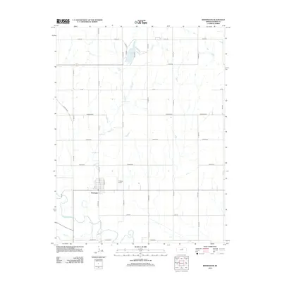
2012 Map of Bennington
USGS Topo · Published 2012About this map
Bennington occupies a central position in this modern survey of eastern Ottawa County, situated just north of the winding Solomon River. The town's grid, including N Nelson St and N Parker St, sits adjacent to the Alderson Airport, illustrating the community's local infrastructure. Northward, the landscape is defined by the recreation area at State Lake, which is fed by Sand Cr and accessed via Lake Dr and Goodwin Dr. The surrounding prairie is organized by a precise section-line road network, featuring routes like Kiowa Rd and Coronado Rd. This 2012 data illustrates the enduring intersection of traditional agricultural land divisions and contemporary rural development in the Kansas heartland.
Find a feature on this map
27 named features on this map. Tap any name to fly to it.
Don’t see what you’re looking for? This feature index may not catch every label — zoom into the map to look around manually.
Map Details
Editions of this 2012 Bennington Map
This is the sole edition of this map. No revisions or reprints were ever made.
Other maps of this area

1889 · Abilene
USGS Topo · 1:125,000

1891 · Clay Center
USGS Topo · 1:125,000

1892 · Salina
USGS Topo · 1:125,000

1892 · Minneapolis
USGS Topo · 1:125,000

1894 · Abilene
USGS Topo · 1:125,000

1942 · Salina
USGS Topo · 1:125,000

1955 · Trenton
USGS Topo · 1:24,000

1955 · Niles
USGS Topo · 1:24,000

1955 · New Cambria
USGS Topo · 1:24,000

1955 · Manhattan
USGS Topo · 1:250,000