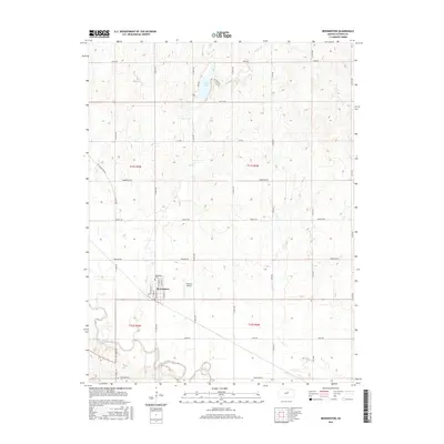
2015 Map of Bennington
USGS Topo · Published 2015About this map
The Solomon River meanders through the southern portion of this landscape, anchoring the settlement of Bennington at the intersection of river valley and prairie. This Ottawa County township is characterized by a precise section-line road grid, including Justice Rd and Coronado Rd, which divide the terrain into large agricultural blocks typical of the Kansas plains. North of the town center, State Lake provides a localized water feature amidst the drainage of Sand Cr, which cuts south toward the river. For those tracing local history, the Bennington Cem stands just outside the residential core, while the presence of Alderson Airport reflects the rural aviation infrastructure of the mid-2010s. The town's street network, featuring N Lincoln St and N Stark St, remains compact and focused on the northern bank of the Solomon.
Find a feature on this map
33 named features on this map. Tap any name to fly to it.
Don’t see what you’re looking for? This feature index may not catch every label — zoom into the map to look around manually.
Map Details
Editions of this 2015 Bennington Map
This is the sole edition of this map. No revisions or reprints were ever made.
Other maps of this area

1889 · Abilene
USGS Topo · 1:125,000

1891 · Clay Center
USGS Topo · 1:125,000

1892 · Salina
USGS Topo · 1:125,000

1892 · Minneapolis
USGS Topo · 1:125,000

1894 · Abilene
USGS Topo · 1:125,000

1942 · Salina
USGS Topo · 1:125,000

1955 · Trenton
USGS Topo · 1:24,000

1955 · Niles
USGS Topo · 1:24,000

1955 · New Cambria
USGS Topo · 1:24,000

1955 · Manhattan
USGS Topo · 1:250,000