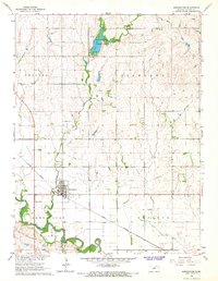
1965 Map of Bennington
USGS Topo · Published 1966About this map
Bennington sits as a central hub in this mid-1960s landscape, positioned near the confluence of Sand Creek and the winding Solomon River. The town layout is clearly defined, featuring a local Cem and a nearby Trailer Park, reflecting the residential character of the era. The presence of the Union Pacific railroad corridor underscores the importance of rail transport to the grain and agriculture-heavy economy of north-central Kansas.
Find a feature on this map
16 named features on this map. Tap any name to fly to it.
Don’t see what you’re looking for? This feature index may not catch every label — zoom into the map to look around manually.
Map Details
Editions of this 1965 Bennington Map
This is the sole edition of this map. No revisions or reprints were ever made.
Other maps of this area

1889 · Abilene
USGS Topo · 1:125,000

1891 · Clay Center
USGS Topo · 1:125,000

1892 · Salina
USGS Topo · 1:125,000

1892 · Minneapolis
USGS Topo · 1:125,000

1894 · Abilene
USGS Topo · 1:125,000

1942 · Salina
USGS Topo · 1:125,000

1955 · Trenton
USGS Topo · 1:24,000

1955 · Niles
USGS Topo · 1:24,000

1955 · New Cambria
USGS Topo · 1:24,000

1955 · Manhattan
USGS Topo · 1:250,000