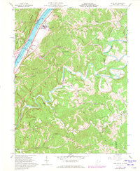
1960 Map of Bens Run
USGS Topo · Published 1973About this map
The Ohio River shoreline defines the western edge of this 1960s landscape, where industrial remnants like a Salt Evaporator and Salt Wells sit near the riverbank. This stretch of the valley is heavily influenced by the Baltimore and Ohio railroad corridor, which connects the riverside communities of Long Reach and Bens Run. Inland from the river, the topography rises sharply into the Grandview National Forest and along the winding course of Middle Island Creek, which snakes through the eastern half of the quadrangle.
Find a feature on this map
68 named features on this map. Tap any name to fly to it.
Don’t see what you’re looking for? This feature index may not catch every label — zoom into the map to look around manually.
Map Details
Editions of this 1960 Bens Run Map
3 editions found
Other maps of this area

1905 · West Union
USGS Topo · 1:62,500

1905 · New Matamoras
USGS Topo · 1:62,500

1906 · Saint Marys
USGS Topo · 1:62,500

1906 · New Martinsville
USGS Topo · 1:62,500

1924 · St Marys
USGS Topo · 1:62,500

1924 · New Martinsville
USGS Topo · 1:62,500

1924 · New Matamoras
USGS Topo · 1:62,500

1924 · West Union
USGS Topo · 1:62,500

1926 · New Martinsville
USGS Topo · 1:62,500

1926 · New Matamoras
USGS Topo · 1:62,500