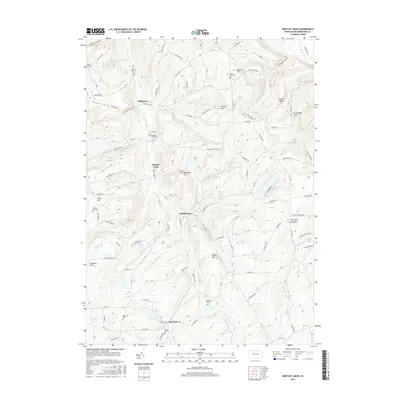
2016 Map of Bentley Creek
USGS Topo · Published 2016About this map
Lake Ondawa and the nearby settlement of Big Pond define the southern landscape of this 2016 survey, where the rolling hills of Bradford County meet a network of historic thoroughfares. The Berwick Tpke serves as a central artery, connecting the small communities of Bentley Creek, Middletown, and Ridgebury. This area is particularly dense with small family and community burial grounds, including the Owen Cem, Crandal Cem, and Hanlon Hill Cem, providing a clear record of local settlement patterns and genealogy. The terrain is marked by prominent ridges such as Draper Ridge and Green Mtn Burnham Hill, which separate numerous narrow valleys and watercourses like Justice Run and Terwilliger Cr. Farther north, the landscape rises toward E Canfield Mtn, while landmarks such as Mormon Hill and the Our Lady of Perpetual Help Cem reflect the social and religious history of the township.
Find a feature on this map
90 named features on this map. Tap any name to fly to it.
Don’t see what you’re looking for? This feature index may not catch every label — zoom into the map to look around manually.
Map Details
Editions of this 2016 Bentley Creek Map
This is the sole edition of this map. No revisions or reprints were ever made.
Other maps of this area

1895 · Elmira
USGS Topo · 1:62,500

1902 · Waverly
USGS Topo · 1:62,500

1905 · Watkins Glen
USGS Topo · 1:125,000

1931 · Troy
USGS Topo · 1:48,000

1938 · Troy
USGS Topo · 1:62,500

1939 · Sayre
USGS Topo · 1:62,500

1942 · Sayre
USGS Topo · 1:62,500

1948 · Sayre
USGS Topo · 1:62,500

1950 · Elmira
USGS Topo · 1:250,000
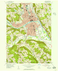
1953 · Elmira
USGS Topo · 1:24,000
Featured Places
- Springfield Township, PA
- Athens Township, PA
- South Creek Township, PA
- Smithfield Township, PA
- Ridgebury Township, PA