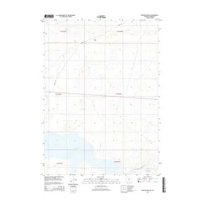
2015 Map of Benton Basin SW
USGS Topo · Published 2015About this map
The Oregon Trail cuts diagonally across the northern landscape of this Natrona County region, marking the enduring path of westward migration through central Wyoming. To the south, the waters of Pathfinder Reservoir dominate the terrain, where the North Platte River drainage gathers behind the historic dam. The transition from the high plains to the reservoir's edge is defined by seasonal watercourses like Horse Cr and Fish Cr, which carve through the arid basin. Near the southern boundary, Bishop Rd provides modern access along the water's edge, while Pino Draw illustrates the rugged drainage patterns that have shaped this high-desert environment since long before the reservoir was filled.
Find a feature on this map
12 named features on this map. Tap any name to fly to it.
Don’t see what you’re looking for? This feature index may not catch every label — zoom into the map to look around manually.
Map Details
Editions of this 2015 Benton Basin SW Map
This is the sole edition of this map. No revisions or reprints were ever made.
Other maps of this area

1951 · Benton Basin SW
USGS Topo · 1:24,000

1951 · Benton Basin
USGS Topo · 1:24,000

1951 · Pathfinder Reservoir NW
USGS Topo · 1:24,000

1951 · Benton Basin NE
USGS Topo · 1:24,000

1951 · Mc Cleary Reservoir
USGS Topo · 1:24,000

1951 · Pathfinder Dam
USGS Topo · 1:24,000

1951 · Fort Ridge
USGS Topo · 1:24,000

1955 · Casper
USGS Topo · 1:250,000

1958 · Casper
USGS Topo · 1:250,000

1959 · Horse Creek Springs
USGS Topo · 1:24,000