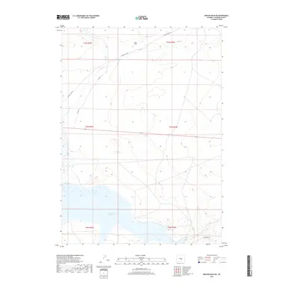
2017 Map of Benton Basin SW
USGS Topo · Published 2017About this map
Pathfinder Reservoir dominates the southern reaches of this landscape, its waters reaching into the high plains of Natrona County. The northern terrain is defined by the ephemeral courses of Horse Cr and Fish Cr, which cut through a series of draws including the notably labeled Pino Draw. This area serves as a transit corridor across the sagebrush steppe, marked by the historic path of Emigrant Trail Rd winding through the northwest. The presence of Co Rd 319 and Bishop Point Rd indicates the sparse network of rural access points used by ranchers and outdoorsmen in this remote Wyoming basin. The survey clearly delineates the rectangular land system, showing the intersections of townships like t30n r84w and t31n r85w against the natural topography and the reservoir's variable shoreline.
Find a feature on this map
13 named features on this map. Tap any name to fly to it.
Don’t see what you’re looking for? This feature index may not catch every label — zoom into the map to look around manually.
Map Details
Editions of this 2017 Benton Basin SW Map
This is the sole edition of this map. No revisions or reprints were ever made.
Other maps of this area

1951 · Benton Basin SW
USGS Topo · 1:24,000

1951 · Benton Basin
USGS Topo · 1:24,000

1951 · Pathfinder Reservoir NW
USGS Topo · 1:24,000

1951 · Benton Basin NE
USGS Topo · 1:24,000

1951 · Mc Cleary Reservoir
USGS Topo · 1:24,000

1951 · Pathfinder Dam
USGS Topo · 1:24,000

1951 · Fort Ridge
USGS Topo · 1:24,000

1955 · Casper
USGS Topo · 1:250,000

1958 · Casper
USGS Topo · 1:250,000

1959 · Horse Creek Springs
USGS Topo · 1:24,000