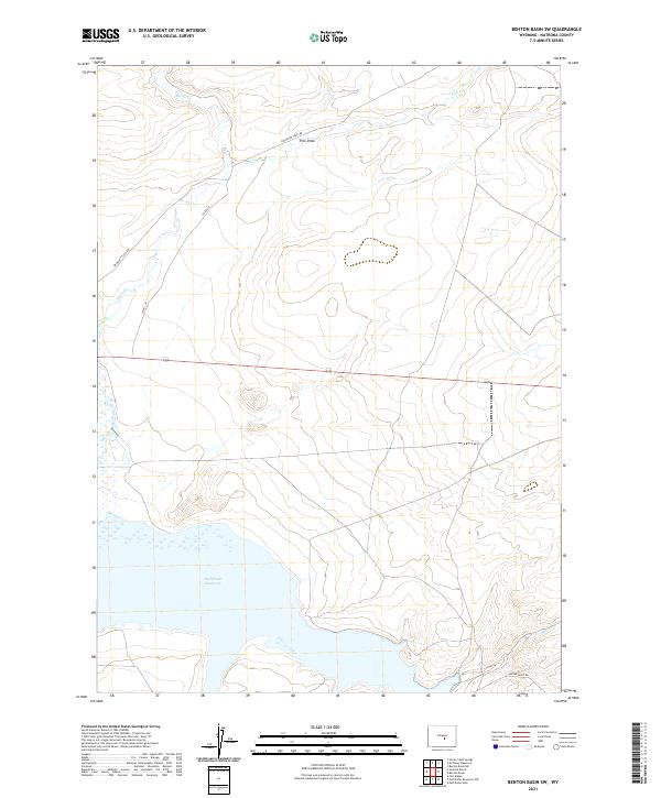
2021 Map of Benton Basin SW
USGS Topo · Published 2021About this map
Pathfinder Reservoir defines the southern reach of this landscape in Natrona County, where the high plains meet the rising drainages of the Casper area. The topography is marked by significant erosion patterns, most notably Pino Draw, which channels toward the intricate systems of Horse Cr and Fish Cr. These waterways dictate the historical movement through the region, as evidenced by the alignment of Emigrant Trail Rd, reflecting the long-established routes across the Wyoming territory. The map reveals a remote ranching and transit landscape, where modern access through Co Rd 319 and Bishop Point Rd follows the same natural contours that guided earlier travelers. This survey provides a clear view of the section lines and township boundaries that partitioned the open range, illustrating how geographic features like creek bends were used to orient land claims in a sparsely populated basin.
Find a feature on this map
14 named features on this map. Tap any name to fly to it.
Don’t see what you’re looking for? This feature index may not catch every label — zoom into the map to look around manually.
Map Details
Editions of this 2021 Benton Basin SW Map
This is the sole edition of this map. No revisions or reprints were ever made.
Other maps of this area

1951 · Benton Basin SW
USGS Topo · 1:24,000

1951 · Benton Basin
USGS Topo · 1:24,000

1951 · Pathfinder Reservoir NW
USGS Topo · 1:24,000

1951 · Benton Basin NE
USGS Topo · 1:24,000

1951 · Mc Cleary Reservoir
USGS Topo · 1:24,000

1951 · Pathfinder Dam
USGS Topo · 1:24,000

1951 · Fort Ridge
USGS Topo · 1:24,000

1955 · Casper
USGS Topo · 1:250,000

1958 · Casper
USGS Topo · 1:250,000

1959 · Horse Creek Springs
USGS Topo · 1:24,000