
1955 Map of Benton
USGS Topo · Published 1956About this map
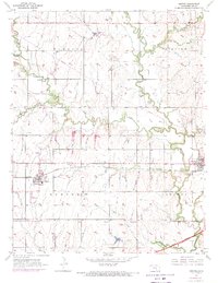
The Missouri Pacific railroad cuts a straight line through the heart of the Kansas prairie, anchoring the agricultural settlements of Benton and Towanda. This mid-century landscape is defined by the winding course of the Whitewater River and its tributaries, including West Branch and Rock Creek. While the terrain is predominantly rural, the presence of an Oil Field with numerous scattered Oil Wells and storage tanks indicates the importance of mineral extraction to the local economy.
Find a feature on this map
23 named features on this map. Tap any name to fly to it.
Don’t see what you’re looking for? This feature index may not catch every label — zoom into the map to look around manually.
Map Details
Editions of this 1955 Benton Map
3 editions found
Other maps of this area

1888 · Eldorado
USGS Topo · 1:125,000

1889 · Wichita
USGS Topo · 1:125,000

1894 · Wichita
USGS Topo · 1:125,000

1945 · Andover
USGS Topo · 1:31,680

1955 · Santa Fe Lake
USGS Topo · 1:24,000

1955 · Greenwich
USGS Topo · 1:24,000

1955 · Wichita
USGS Topo · 1:250,000
1956 · Andover
USGS Topo · 1:24,000

1958 · Wichita
USGS Topo · 1:250,000
1960 · Greenwich
USGS Topo · 1:24,000