1955 Map of Benton
USGS Topo · Published 1983About this map
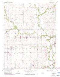
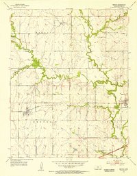
Benton and Towanda anchor this mid-century portrait of Butler County, where the transition from pioneer rail hubs to modern transit is clearly visible. The Missouri Pacific tracks bisect the landscape, passing the Benton Airfield and the historic Old Benton Cem, while the newer Kansas Turnpike Toll Road cuts across the southeast corner. Significant historical markers like the Old Indian Boundary provide a deeper layer of territorial history beneath the 1950s infrastructure. The landscape is defined by the winding Whitewater River and its many tributaries, including Wildcat Creek and Prairie Creek. Pockets of industry are evident through numerous Oil Wells and a dedicated Oil Field, illustrating the region's reliance on both agriculture and petroleum. Smaller aviation landmarks like the Green-Miller Landing Strip highlight the post-war expansion of private flight in rural Kansas.
Find a feature on this map
28 named features on this map. Tap any name to fly to it.
Don’t see what you’re looking for? This feature index may not catch every label — zoom into the map to look around manually.
Map Details
Editions of this 1955 Benton Map
3 editions found
Other maps of this area

1888 · Eldorado
USGS Topo · 1:125,000

1889 · Wichita
USGS Topo · 1:125,000

1894 · Wichita
USGS Topo · 1:125,000
1945 · Andover
USGS Topo · 1:31,680
1955 · Santa Fe Lake
USGS Topo · 1:24,000
1955 · Benton
USGS Topo · 1:24,000
1955 · Greenwich
USGS Topo · 1:24,000

1955 · Wichita
USGS Topo · 1:250,000
1956 · Andover
USGS Topo · 1:24,000

1958 · Wichita
USGS Topo · 1:250,000