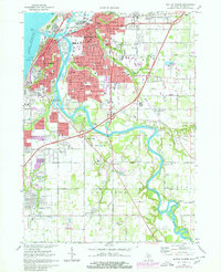
1970 Map of Benton Harbor
USGS Topo · Published 1980About this map
Benton Harbor and St Joseph anchor this coastal landscape where the St Joseph River meets Lake Michigan. The 1970s expansion of the urban area is clearly visible in the purple revisions, highlighting growth in residential areas like Fair Plain and Benton Heights. The map documents a complex social and religious geography, featuring the House of David estate alongside numerous local institutions such as Lake Michigan College and Mercy Hospital. The river forms a natural boundary between the two primary cities, with specialized riverfront features like Kings Landing and the Oxbow providing a look at the transition from industrial harbor to inland waterway. Further south, the rural character of Royalton Twp and Lincoln Twp is marked by scattered schools and churches, including Lakeshore High Sch and St Lukes Ch, showing the gradual sprawl away from the twin cities.
Find a feature on this map
117 named features on this map. Tap any name to fly to it.
Don’t see what you’re looking for? This feature index may not catch every label — zoom into the map to look around manually.
Map Details
Editions of this 1970 Benton Harbor Map
2 editions found
Other maps of this area

1927 · Niles
USGS Topo · 1:62,500

1927 · Benton Harbor
USGS Topo · 1:62,500

1930 · Three Oaks
USGS Topo · 1:62,500

1930 · Benton Harbor
USGS Topo · 1:62,500

1930 · Niles
USGS Topo · 1:62,500

1943 · Niles
USGS Topo · 1:62,500

1944 · Three Oaks
USGS Topo · 1:62,500

1953 · Chicago
USGS Topo · 1:250,000

1957 · Chicago
USGS Topo · 1:250,000

1958 · Racine
USGS Topo · 1:250,000