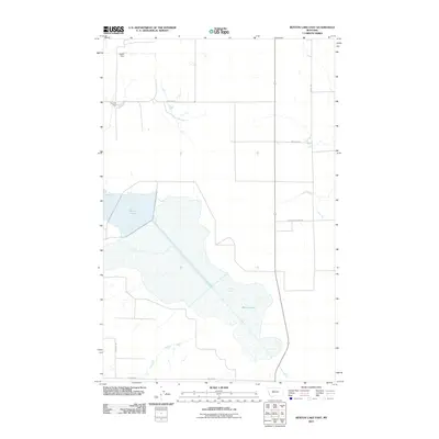
2011 Map of Benton Lake East
USGS Topo · Published 2011About this map
Benton Lake dominates this portion of the Montana prairie in Cascade County, appearing here as a massive, intricate wetland complex vital to the region's hydrography. The 2011 survey reveals a landscape defined by water management and rural infrastructure, where structures like Kodak Dam and Toy Box Dam regulate the flow of water across the open terrain. The map reflects a modern era of land use where section lines are traced by a network of gravel and improved roads, including Power Rd E and Anderson Rd. This grid-like development contrasts with the irregular, organic spread of the lake's marshy reaches, illustrating the intersection of natural water systems and the agricultural grid. Smaller features like Black Horse Lake Rd and Darby Rd provide access to the various waterfowl and wildlife management areas that characterize this stretch of the Great Plains.
Find a feature on this map
8 named features on this map. Tap any name to fly to it.
Don’t see what you’re looking for? This feature index may not catch every label — zoom into the map to look around manually.
Map Details
Editions of this 2011 Benton Lake East Map
This is the sole edition of this map. No revisions or reprints were ever made.
Other maps of this area

1886 · Great Falls
USGS Topo · 1:250,000

1948 · Portage
USGS Topo · 1:62,500

1949 · Portage
USGS Topo · 1:62,500

1949 · Timber Coulee
USGS Topo · 1:62,500

1949 · Great Falls
USGS Topo · 1:62,500

1950 · Timber Coulee
USGS Topo · 1:62,500

1950 · Dent Bridge
USGS Topo · 1:62,500

1951 · Great Falls
USGS Topo · 1:62,500

1954 · Great Falls
USGS Topo · 1:250,000

1957 · Great Falls
USGS Topo · 1:250,000