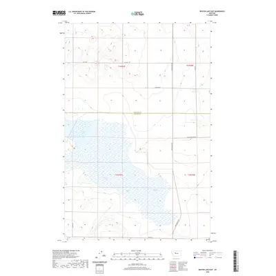
2020 Map of Benton Lake East
USGS Topo · Published 2020About this map
Benton Lake dominates the central and southern portions of this Montana landscape, where the waters are divided by the sectional grid lines of the Public Land Survey System. The map documents the boundary between Chouteau Co and Cascade Co, illustrating how these administrative lines intersect with the natural hydrology of the region. A network of rural routes, including the prominent north-south Bootlegger Trl, provides access to the surrounding townships. The terrain is characterized by a high-plains character with subtle elevation changes, marked by local roads such as 8th Rd Ne and Wilson Rd that follow the established section lines of t23n r3e and t22n r4e. This contemporary survey reflects the enduring structure of Montana's agricultural and wetland landscapes.
Find a feature on this map
12 named features on this map. Tap any name to fly to it.
Don’t see what you’re looking for? This feature index may not catch every label — zoom into the map to look around manually.
Map Details
Editions of this 2020 Benton Lake East Map
This is the sole edition of this map. No revisions or reprints were ever made.
Other maps of this area

1886 · Great Falls
USGS Topo · 1:250,000

1948 · Portage
USGS Topo · 1:62,500

1949 · Portage
USGS Topo · 1:62,500

1949 · Timber Coulee
USGS Topo · 1:62,500

1949 · Great Falls
USGS Topo · 1:62,500

1950 · Timber Coulee
USGS Topo · 1:62,500

1950 · Dent Bridge
USGS Topo · 1:62,500

1951 · Great Falls
USGS Topo · 1:62,500

1954 · Great Falls
USGS Topo · 1:250,000

1957 · Great Falls
USGS Topo · 1:250,000