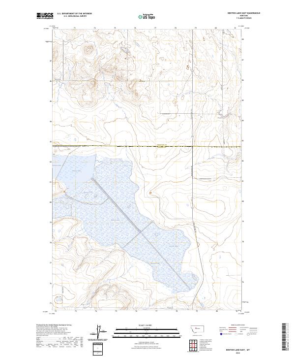
2024 Map of Benton Lake East
USGS Topo · Published 2024About this map
Benton Lake National Wildlife Refuge dominates this landscape on the border of Cascade and Chouteau counties, preserving a vital wetland complex in north-central Montana. The extensive waters of Benton Lake provide a central focus for the region, managed for conservation and wildlife habitat. This modern survey reflects the enduring character of the High Plains, where the grid of the Public Land Survey System defines the layout of ranch roads and section boundaries. A network of rural routes, including Bootlegger Trl, Anderson Rd, and Darby Rd, provides access across the open terrain, connecting remote homesteads and agricultural operations. The map illustrates the specific geography of these prairie wetlands before they transition into the surrounding uplands, capturing the contemporary management of one of the area's most significant natural landmarks.
Find a feature on this map
13 named features on this map. Tap any name to fly to it.
Don’t see what you’re looking for? This feature index may not catch every label — zoom into the map to look around manually.
Map Details
Editions of this 2024 Benton Lake East Map
This is the sole edition of this map. No revisions or reprints were ever made.
Other maps of this area

1886 · Great Falls
USGS Topo · 1:250,000

1948 · Portage
USGS Topo · 1:62,500

1949 · Portage
USGS Topo · 1:62,500

1949 · Timber Coulee
USGS Topo · 1:62,500

1949 · Great Falls
USGS Topo · 1:62,500

1950 · Timber Coulee
USGS Topo · 1:62,500

1950 · Dent Bridge
USGS Topo · 1:62,500

1951 · Great Falls
USGS Topo · 1:62,500

1954 · Great Falls
USGS Topo · 1:250,000

1957 · Great Falls
USGS Topo · 1:250,000