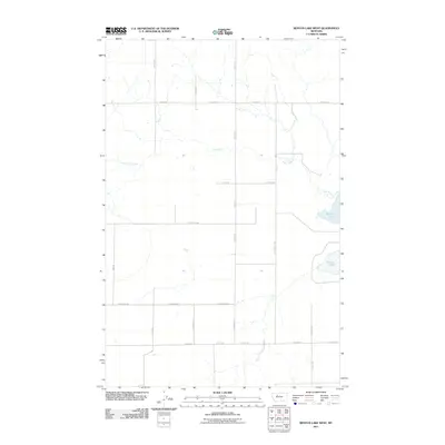
2011 Map of Benton Lake West
USGS Topo · Published 2011About this map
Benton Lake dominates the eastern edge of this landscape in north-central Montana, where the prairie is organized by a strict rectilinear grid of rural roads. The area is defined by its wide-open drainage patterns, with the meandering course of Lake Creek cutting westward through the township. The infrastructure is primarily composed of local routes such as Hevron Rd and North Wilson Rd, which serve the large agricultural tracts and family-named homestead sites. This 2011 survey by the U.S. Geological Survey illustrates the enduring rural character of the region, showing how the landscape remains divided by long-standing boundary markers like Anderson Rd and Gunderson Rd. The lack of dense settlement or commercial hubs highlights a region dedicated to ranching and dry-land farming, where water features like the lake and creek are the primary geographical landmarks.
Find a feature on this map
18 named features on this map. Tap any name to fly to it.
Don’t see what you’re looking for? This feature index may not catch every label — zoom into the map to look around manually.
Map Details
Editions of this 2011 Benton Lake West Map
This is the sole edition of this map. No revisions or reprints were ever made.
Other maps of this area

1886 · Great Falls
USGS Topo · 1:250,000

1949 · Timber Coulee
USGS Topo · 1:62,500

1949 · Great Falls
USGS Topo · 1:62,500

1949 · Vaughn
USGS Topo · 1:62,500

1950 · Timber Coulee
USGS Topo · 1:62,500

1950 · Dutton
USGS Topo · 1:62,500

1951 · Great Falls
USGS Topo · 1:62,500

1952 · Vaughn
USGS Topo · 1:62,500

1954 · Great Falls
USGS Topo · 1:250,000

1957 · Great Falls
USGS Topo · 1:250,000