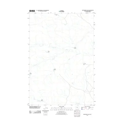
2011 Map of Bentonite Flats
USGS Topo · Published 2011About this map
Bentonite Flats and the surrounding drainages in Big Horn County define this landscape as it appeared in the early 21st century. The terrain is deeply carved by a network of seasonal and perennial waterways, most notably Big Woody Creek, Little Woody Creek, and the larger Woody Creek system. The presence of several numbered catchment structures, such as Crow Number 32 Dam and Crow Number 20 Dam, reflects the region's managed water resources for livestock and land management. To the south, the map details the path of Beauvais Creek, while individual property or project-specific landmarks like the J R Scott Number 12 Dam and Coibson Number 1 Dam provide specific points of reference for local historians or land researchers tracing water rights and ranching boundaries.
Find a feature on this map
11 named features on this map. Tap any name to fly to it.
Don’t see what you’re looking for? This feature index may not catch every label — zoom into the map to look around manually.
Map Details
Editions of this 2011 Bentonite Flats Map
This is the sole edition of this map. No revisions or reprints were ever made.
Other maps of this area

1893 · Huntley
USGS Topo · 1:125,000

1894 · St. Xavier
USGS Topo · 1:125,000

1894 · Fort Custer
USGS Topo · 1:125,000

1901 · St. Xavier
USGS Topo · 1:125,000

1915 · Spenceville
USGS Topo · 1:31,680

1954 · Billings
USGS Topo · 1:250,000

1954 · Hardin
USGS Topo · 1:250,000

1957 · Hardin
USGS Topo · 1:250,000

1957 · Billings
USGS Topo · 1:250,000

1958 · Billings
USGS Topo · 1:250,000