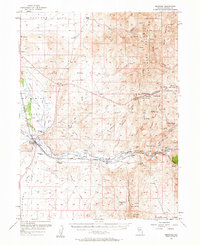
1957 Map of Beowawe
USGS Topo · Published 1963About this map
The Humboldt River carves a critical path through this basin and range landscape, serving as the historical corridor for the California Trail and Emigrant Route. This 1957 survey documents the intersection of pioneer history and mid-century infrastructure, where the Southern Pacific and Western Pacific railroads parallel the river's course near the settlement of Beowawe. The map identifies several poignant landmarks of the westward migration, including the Maidens Grave Cemetery and the Pioneers Grave situated along the riverbanks.
Find a feature on this map
99 named features on this map. Tap any name to fly to it.
Don’t see what you’re looking for? This feature index may not catch every label — zoom into the map to look around manually.
Map Details
Editions of this 1957 Beowawe Map
2 editions found
Other maps of this area

1949 · Crescent Valley
USGS Topo · 1:62,500

1950 · Crescent Valley
USGS Topo · 1:62,500

1952 · Pine Valley
USGS Topo · 1:62,500

1952 · Carlin
USGS Topo · 1:62,500

1955 · Winnemucca
USGS Topo · 1:250,000

1957 · Frenchie Creek
USGS Topo · 1:62,500

1957 · Dunphy
USGS Topo · 1:62,500

1957 · Beowawe
USGS Topo · 1:62,500

1958 · Winnemucca
USGS Topo · 1:250,000

1962 · Winnemucca
USGS Topo · 1:250,000