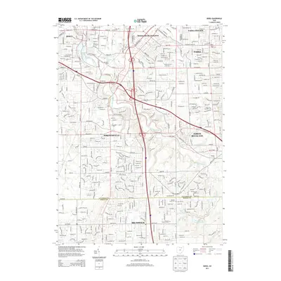
2013 Map of Berea
USGS Topo · Published 2013About this map
The East Branch Rocky River carves through a dense suburban corridor south of Cleveland, framing the development patterns of Berea, Strongsville, and Middleburg Heights. The landscape is a mix of educational institutions like Baldwin-Wallace Coll and localized recreational water bodies including Wallace Lake, Coe Lake, and Baldwin Lake. This early 21st-century record highlights the significant concentration of community spaces, from the many neighborhood cemeteries such as Woodvale Cem and German Lutheran Cem to the sprawling Pine Hills Golf Course Club Lake further south in Brunswick. The transit infrastructure is dominated by the intersection of major routes like Royalton Rd and Albion Rd, which serve the residential expansion across the Cuyahoga County and Medina County line.
Find a feature on this map
48 named features on this map. Tap any name to fly to it.
Don’t see what you’re looking for? This feature index may not catch every label — zoom into the map to look around manually.
Map Details
Editions of this 2013 Berea Map
This is the sole edition of this map. No revisions or reprints were ever made.
Other maps of this area

1902 · Berea
USGS Topo · 1:62,500

1903 · Cleveland
USGS Topo · 1:62,500

1903 · Akron
USGS Topo · 1:62,500

1904 · Berea
USGS Topo · 1:62,500

1904 · Medina
USGS Topo · 1:62,500

1905 · Akron
USGS Topo · 1:62,500

1906 · Medina
USGS Topo · 1:62,500

1950 · Cleveland
USGS Topo · 1:250,000

1953 · West View
USGS Topo · 1:24,000

1953 · Broadview Heights
USGS Topo · 1:24,000