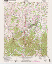
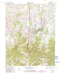
1970 Map of Berea
USGS Topo · Published 1993About this map
Berea College anchors this survey of central Kentucky, illustrating the town's expansion and the academic hub's central role in the regional landscape. The map captures the meeting of the Bluegrass and the Knobs, where the relatively level terrain around Berea gives way to the abrupt elevation of Dead Horse Knob and Bear Mtn. This topographical shift is reflected in the land use patterns, as dense street grids and institutional buildings transition into the winding valley roads and scattered homesteads of the southern hills. Local family history is preserved through numerous marked burials such as the Johnson Cem and Williams Cem, while community centers like Middletown Ch and Bethel Ch highlight the area's rural social fabric. The transportation corridor follows the CSX Transportation rail line and the modern interstate, cutting through the historic crossing at Boone Gap where the Madison and Rockcastle County line is established.
Find a feature on this map
53 named features on this map. Tap any name to fly to it.
Don’t see what you’re looking for? This feature index may not catch every label — zoom into the map to look around manually.
Map Details
Editions of this 1970 Berea Map
5 editions found
Other maps of this area

1892 · Richmond
USGS Topo · 1:125,000

1893 · London
USGS Topo · 1:125,000

1897 · Richmond
USGS Topo · 1:125,000

1897 · London
USGS Topo · 1:125,000

1952 · Berea
USGS Topo · 1:24,000

1952 · Paint Lick
USGS Topo · 1:24,000

1952 · Kirksville
USGS Topo · 1:24,000

1952 · Bighill
USGS Topo · 1:24,000

1952 · Moberly
USGS Topo · 1:24,000

1953 · Richmond South
USGS Topo · 1:24,000