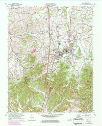
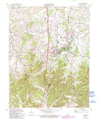
1970 Map of Berea
USGS Topo · Published 1984About this map
Berea College anchors this Madison County landscape, where the campus and town core are flanked by a series of outlying settlements and family landmarks. The Louisville and Nashville railroad serves as a central artery, cutting south through the valley toward Boone Gap. To the north and west, the terrain transitions into a patchwork of rural communities like Farristown and Wallaceton, characterized by numerous small churches and family burial grounds such as Johnson Cem and Silver Creek Cem.
Find a feature on this map
47 named features on this map. Tap any name to fly to it.
Don’t see what you’re looking for? This feature index may not catch every label — zoom into the map to look around manually.
Map Details
Editions of this 1970 Berea Map
5 editions found
Other maps of this area

1892 · Richmond
USGS Topo · 1:125,000

1893 · London
USGS Topo · 1:125,000

1897 · Richmond
USGS Topo · 1:125,000

1897 · London
USGS Topo · 1:125,000

1952 · Berea
USGS Topo · 1:24,000

1952 · Paint Lick
USGS Topo · 1:24,000

1952 · Kirksville
USGS Topo · 1:24,000

1952 · Bighill
USGS Topo · 1:24,000

1952 · Moberly
USGS Topo · 1:24,000

1953 · Richmond South
USGS Topo · 1:24,000