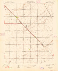
1948 Map of Berenda
USGS Topo · Published 1948About this map
The agrarian landscape of Madera County is anchored by the Southern Pacific railroad corridor, which dictates the placement of early Central Valley settlements. Originally mapped in 1916 and updated shortly after the war, this survey captures Chowchilla and Berenda during a period of established irrigation and road development. The grid-based settlement pattern is evident through named thoroughfares such as Lincoln Road and Jefferson Road, which connect isolated rural schools like Dixieland Sch to the larger rail hubs.
Find a feature on this map
15 named features on this map. Tap any name to fly to it.
Don’t see what you’re looking for? This feature index may not catch every label — zoom into the map to look around manually.
Map Details
Editions of this 1948 Berenda Map
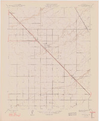
2 editions found
Other maps of this area

1916 · Berenda
USGS Topo · 1:31,680

1918 · Chowchilla
USGS Topo · 1:31,680

1918 · Berenda
USGS Topo · 1:31,680

1918 · La Grand
USGS Topo · 1:31,680

1919 · Plainsberg
USGS Topo · 1:31,680

1919 · Raynor Creek
USGS Topo · 1:31,680

1920 · Kismet
USGS Topo · 1:31,680

1920 · Bonita Ranch
USGS Topo · 1:31,680

1921 · Bonita Ranch
USGS Topo · 1:31,680

1922 · Kentucky Well
USGS Topo · 1:31,680