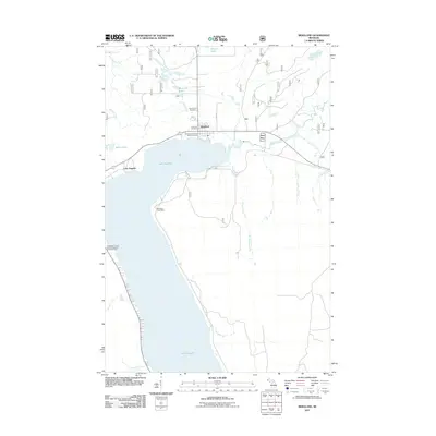
2011 Map of Bergland
USGS Topo · Published 2011About this map
Lake Gogebic dominates the southwestern portion of this map, its northern shoreline serving as the focal point for the community of Bergland. In the early 21st century, the area is characterized by a mix of recreational infrastructure and established local services, including the Bergland Post Office and Bergland Township Park Picnic Area. The terrain is carved by a complex drainage network, with the Big Iron River and the West Branch Ontonagon River flowing through the north and east. Genealogists and local historians will find significant value in the documentation of local burial sites, specifically Forest Lawn Cemetery and Lakeview Cemetery, which sit just north of the township center. The landscape remains largely defined by its water bodies, from smaller features like Stanko Lake and Berland Lake to the numerous tributaries such as Knute Creek and Amundson Creek that feed into the larger river systems of Ontonagon County.
Find a feature on this map
25 named features on this map. Tap any name to fly to it.
Don’t see what you’re looking for? This feature index may not catch every label — zoom into the map to look around manually.
Map Details
Editions of this 2011 Bergland Map
This is the sole edition of this map. No revisions or reprints were ever made.
Other maps of this area

1949 · Matchwood NW
USGS Topo · 1:24,000

1949 · Bergland NE
USGS Topo · 1:24,000

1952 · Thayer
USGS Topo · 1:62,500

1955 · Marenisco
USGS Topo · 1:62,500

1955 · Marenisco
USGS Topo · 1:24,000

1956 · Bergland NE
USGS Topo · 1:24,000

1956 · Bergland
USGS Topo · 1:62,500

1956 · Matchwood NW
USGS Topo · 1:24,000

1956 · Matchwood
USGS Topo · 1:62,500

1958 · Iron River
USGS Topo · 1:250,000