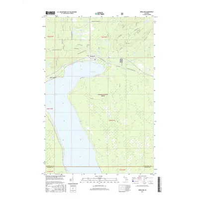
2017 Map of Bergland
USGS Topo · Published 2017About this map
Lake Gogebic dominates the western edge of this Upper Peninsula landscape, where the settlement of Bergland sits at the northern terminus of the lake. This area is characterized by a high concentration of recreational and forest infrastructure, as seen in the numerous trails such as Bergland Ski and the Bessemer Snowmobile #8. The map documents a heavily managed timber and conservation environment within the Ottawa National Forest, where the terrain rises toward Gogebic Ridge. Waterways like the West Branch Ontonagon River and Pig Iron River drain the surrounding highlands into the basin. Genealogists and local historians can find burial sites at Forest Lawn Cem and Lakeview Cem, both located north of the Bergland Bay shoreline, providing specific points of interest for family research in Ontonagon County.
Find a feature on this map
45 named features on this map. Tap any name to fly to it.
Don’t see what you’re looking for? This feature index may not catch every label — zoom into the map to look around manually.
Map Details
Editions of this 2017 Bergland Map
This is the sole edition of this map. No revisions or reprints were ever made.
Other maps of this area

1949 · Matchwood NW
USGS Topo · 1:24,000

1949 · Bergland NE
USGS Topo · 1:24,000

1952 · Thayer
USGS Topo · 1:62,500

1955 · Marenisco
USGS Topo · 1:62,500

1955 · Marenisco
USGS Topo · 1:24,000

1956 · Bergland NE
USGS Topo · 1:24,000

1956 · Bergland
USGS Topo · 1:62,500

1956 · Matchwood NW
USGS Topo · 1:24,000

1956 · Matchwood
USGS Topo · 1:62,500

1958 · Iron River
USGS Topo · 1:250,000