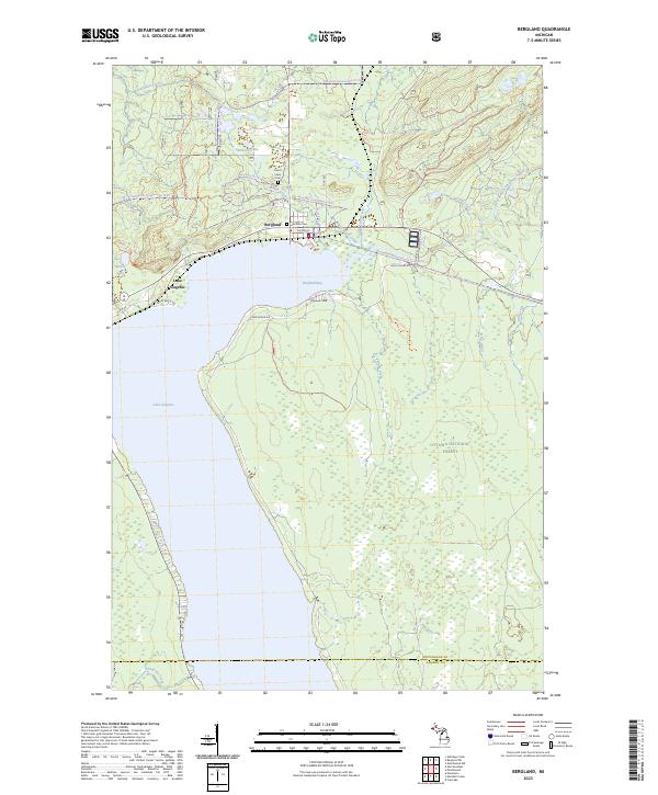
2023 Map of Bergland
USGS Topo · Published 2023About this map
Bergland sits at the northern terminus of Lake Gogebic, serving as a central hub for the surrounding timberlands and recreational trails. This modern survey illustrates the town's position between Bergland Bay and the higher elevations of Gogebic Ridge, where the local landscape is defined by a dense network of forest service roads and recreational paths. Significant local landmarks include Forest Lawn Cem and Lake Side Cem, which provide valuable touchpoints for genealogists researching the families of this Upper Peninsula community.
Find a feature on this map
46 named features on this map. Tap any name to fly to it.
Don’t see what you’re looking for? This feature index may not catch every label — zoom into the map to look around manually.
Map Details
Editions of this 2023 Bergland Map
This is the sole edition of this map. No revisions or reprints were ever made.
Other maps of this area

1949 · Matchwood NW
USGS Topo · 1:24,000

1949 · Bergland NE
USGS Topo · 1:24,000

1952 · Thayer
USGS Topo · 1:62,500

1955 · Marenisco
USGS Topo · 1:62,500

1955 · Marenisco
USGS Topo · 1:24,000

1956 · Bergland NE
USGS Topo · 1:24,000

1956 · Bergland
USGS Topo · 1:62,500

1956 · Matchwood NW
USGS Topo · 1:24,000

1956 · Matchwood
USGS Topo · 1:62,500

1958 · Iron River
USGS Topo · 1:250,000