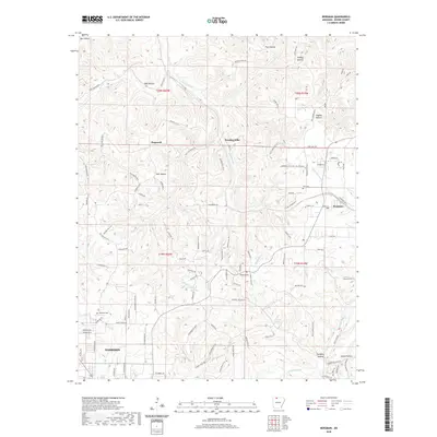
2020 Map of Bergman
USGS Topo · Published 2020About this map
The northern edge of Harrison and the surrounding Boone County terrain are defined by a complex network of winding hollows and drainages. This high-resolution topographic survey captures the rural character of the area as it appeared in 2020, centered on the settlement of Bergman and the nearby communities of Hopewell and Wooden Hills. The landscape is etched by water, with Crooked Creek flowing across the southern sections and the Marble Fork and Sugar Orchard Creek carving through the limestone-rich Ozark topography.
Find a feature on this map
110 named features on this map. Tap any name to fly to it.
Don’t see what you’re looking for? This feature index may not catch every label — zoom into the map to look around manually.
Map Details
Editions of this 2020 Bergman Map
This is the sole edition of this map. No revisions or reprints were ever made.
Other maps of this area

1893 · Yellville
USGS Topo · 1:125,000

1903 · Yellville
USGS Topo · 1:125,000

1904 · Harrison
USGS Topo · 1:125,000

1905 · Harrison
USGS Topo · 1:125,000

1905 · Yellville
USGS Topo · 1:125,000

1929 · Yellville
USGS Topo · 1:125,000

1945 · Harrison
USGS Topo · 1:250,000

1949 · Harrison
USGS Topo · 1:250,000

1954 · Harrison
USGS Topo · 1:250,000

1958 · Harrison
USGS Topo · 1:250,000