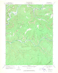
1966 Map of Bergoo
USGS Topo · Published 1970About this map
The extractive industries of Webster County dominate this mid-century landscape, where the Baltimore and Ohio and Western Maryland rail lines snake through deep river valleys to serve numerous resource sites. Small settlements like Bergoo, Parcoal, and Jerryville are centers of activity, with a notable tipple and substation marking the industrial infrastructure. The map reveals an intensive pattern of both subsurface mines and extensive strip mines that scar the high ridges of the Gauley Mountains and Gauley Divide.
Find a feature on this map
66 named features on this map. Tap any name to fly to it.
Don’t see what you’re looking for? This feature index may not catch every label — zoom into the map to look around manually.
Map Details
Editions of this 1966 Bergoo Map
2 editions found
Other maps of this area

1891 · Huntersville
USGS Topo · 1:125,000

1893 · Buckhannon
USGS Topo · 1:125,000

1894 · Huntersville
USGS Topo · 1:125,000

1896 · Buckhannon
USGS Topo · 1:125,000

1897 · Buckhannon
USGS Topo · 1:125,000

1913 · Hacker Valley
USGS Topo · 1:48,000

1913 · Pickens
USGS Topo · 1:48,000

1915 · Webster Springs
USGS Topo · 1:48,000

1915 · Hacker Valley
USGS Topo · 1:62,500

1915 · Pickens
USGS Topo · 1:62,500