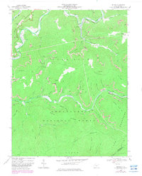
1966 Map of Bergoo
USGS Topo · Published 1982About this map
The extractive economy of Webster County's highlands defines this 1966 landscape, where the confluence of the Elk River and Leatherwood Creek at Bergoo serves as a hub for mining and rail activity. Dozens of Strip Mines and deep mines dot the steep ridges of Jonathan Knob, Pompeys Knob, and Cold Knob, linked by a complex network of Jeep Trails and the Baltimore and Ohio railroad. Industrial infrastructure is prominent throughout the terrain, including a Substation at Bergoo and a Tipple and Tailings Ponds near Jerryville.
Find a feature on this map
66 named features on this map. Tap any name to fly to it.
Don’t see what you’re looking for? This feature index may not catch every label — zoom into the map to look around manually.
Map Details
Editions of this 1966 Bergoo Map
2 editions found
Other maps of this area

1891 · Huntersville
USGS Topo · 1:125,000

1893 · Buckhannon
USGS Topo · 1:125,000

1894 · Huntersville
USGS Topo · 1:125,000

1896 · Buckhannon
USGS Topo · 1:125,000

1897 · Buckhannon
USGS Topo · 1:125,000

1913 · Hacker Valley
USGS Topo · 1:48,000

1913 · Pickens
USGS Topo · 1:48,000

1915 · Webster Springs
USGS Topo · 1:48,000

1915 · Hacker Valley
USGS Topo · 1:62,500

1915 · Pickens
USGS Topo · 1:62,500