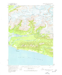
1959 Map of Bering Glacier A-4
USGS Topo · Published 1977About this map
Cape Yakataga serves as the primary coastal landmark where the Gulf of Alaska meets the mouth of the Yakataga River. During this mid-century period, the landscape reflects a transition from glacial wilderness to early industrial exploration, evidenced by scattered cabins and a drill hole near the eastern shore. The remote coastline is supported by the Yakataga Airport, complete with a Beacon and Radio Facility, highlighting the area's reliance on bush aviation for connectivity.
Find a feature on this map
37 named features on this map. Tap any name to fly to it.
Don’t see what you’re looking for? This feature index may not catch every label — zoom into the map to look around manually.
Map Details
Editions of this 1959 Bering Glacier A-4 Map
2 editions found
Other maps of this area

1948 · Bering Glacier A-4
USGS Topo · 1:63,360

1950 · Bering Glacier A-3
USGS Topo · 1:63,360

1950 · Bering Glacier
USGS Topo · 1:250,000

1950 · Icy Bay
USGS Topo · 1:250,000

1951 · Icy Bay
USGS Topo · 1:250,000

1951 · Bering Glacier
USGS Topo · 1:250,000
1951 · Bering Glacier A-4
USGS Topo · 1:63,360

1959 · Bering Glacier
USGS Topo · 1:250,000
1959 · Bering Glacier A-3
USGS Topo · 1:63,360
1959 · Bering Glacier A-4
USGS Topo · 1:63,360