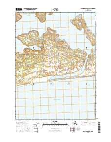
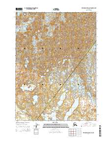
2016 Map of Bering Glacier A-7 SW
USGS Topo · Published 2016About this map
Beringia Novaya sits at the edge of a dynamic coastal landscape where the glacial influence meets the sea. This 2016 survey highlights a complex network of wetlands and shifting hydrology, dominated by the meandering course of the Seal River. The river flows south through several channels, eventually meeting the open waters of the Gulf of Alaska. The terrain is characterized by intricate elevation contours that reveal the subtle rises and depressions typical of this glacial outwash region, providing an essential record of the shoreline and interior drainage patterns before further natural shifts occur. This map is particularly valuable for researchers tracking coastal changes and the specific layout of the local landscape in the early 21st century.
Find a feature on this map
7 named features on this map. Tap any name to fly to it.
Don’t see what you’re looking for? This feature index may not catch every label — zoom into the map to look around manually.
Map Details
Editions of this 2016 Bering Glacier A-7 SW Map
This is the sole edition of this map. No revisions or reprints were ever made.
Other maps of this area

1950 · Bering Glacier
USGS Topo · 1:250,000

1950 · Icy Bay
USGS Topo · 1:250,000

1951 · Icy Bay
USGS Topo · 1:250,000

1951 · Bering Glacier
USGS Topo · 1:250,000

1959 · Bering Glacier
USGS Topo · 1:250,000

1961 · Icy Bay
USGS Topo · 1:250,000
1984 · Bering Glacier A-8
USGS Topo · 1:63,360
1984 · Bering Glacier A-7
USGS Topo · 1:63,360
2014 · Bering Glacier A-8 SE
USGS Topo · 1:25,000
2014 · Bering Glacier A-8 NE
USGS Topo · 1:25,000