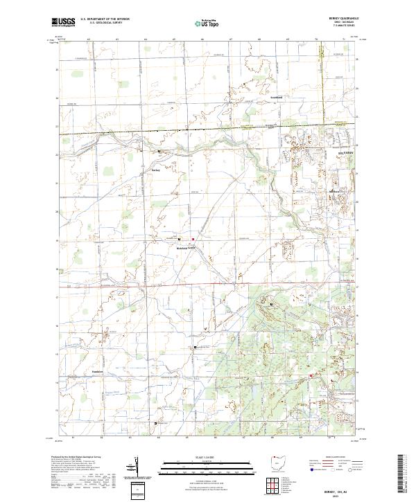
2023 Map of Berkey
USGS Topo · Published 2023About this map
Richfield Center and the village of Berkey anchor this agricultural region along the border of Ohio and Michigan. The landscape is defined by an extensive network of drainage infrastructure, including Frankfort Ditch, Grace Ditch, and Wiregrass Ditch, which support the productive farmland around Frankfort and Mitchaw. This system feeds into Tenmile Creek, which meanders through the northern section of the territory. For genealogists and local historians, several burial grounds provide important links to the past, such as Wolfinger Cem, Saint Elizabeth Cem, and Ford Cem. The map illustrates the contemporary intersection of rural heritage and suburban expansion, particularly as the western edge of Sylvania begins to reach into these historically agrarian spaces.
Find a feature on this map
39 named features on this map. Tap any name to fly to it.
Don’t see what you’re looking for? This feature index may not catch every label — zoom into the map to look around manually.
Map Details
Editions of this 2023 Berkey Map
This is the sole edition of this map. No revisions or reprints were ever made.
Other maps of this area

1900 · Toledo
USGS Topo · 1:62,500

1911 · Swanton
USGS Topo · 1:62,500

1912 · Dundee
USGS Topo · 1:62,500

1914 · Swanton
USGS Topo · 1:62,500

1926 · Dundee
USGS Topo · 1:62,500

1935 · Whitehouse
USGS Topo · 1:24,000

1935 · Maumee
USGS Topo · 1:24,000

1935 · Berkey
USGS Topo · 1:24,000
1937 · Sylvania
USGS Topo · 1:31,680
1938 · Maumee
USGS Topo · 1:31,680