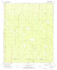
1973 Map of Berlin
USGS Topo · Published 1975About this map
Chemin-A-Haut Creek and its southern counterpart, Chemin-A-Haut Bayou, anchor this 1970s landscape where the Arkansas and Louisiana state line meets the Ashley County and Morehouse Parish border. The area is defined by a network of rural settlements and small gathering places, including Berlin, Rawls, and Rolfe Junction. A significant historical remnant is the Old Railroad Grade running north-south through the eastern half of the quadrangle, indicating a former timber or transport corridor that once connected these remote communities.
Find a feature on this map
23 named features on this map. Tap any name to fly to it.
Don’t see what you’re looking for? This feature index may not catch every label — zoom into the map to look around manually.
Map Details
Editions of this 1973 Berlin Map
This is the sole edition of this map. No revisions or reprints were ever made.
Other maps of this area

1935 · Wilmot
USGS Topo · 1:62,500

1935 · Naff
USGS Topo · 1:62,500

1935 · Bonita
USGS Topo · 1:62,500

1953 · Greenwood
USGS Topo · 1:250,000

1955 · Jackson
USGS Topo · 1:250,000

1956 · Greenwood
USGS Topo · 1:250,000

1956 · Bastrop
USGS Topo · 1:62,500

1958 · Bonita
USGS Topo · 1:62,500

1960 · Wilmot
USGS Topo · 1:62,500

1960 · Wilmot NW
USGS Topo · 1:24,000