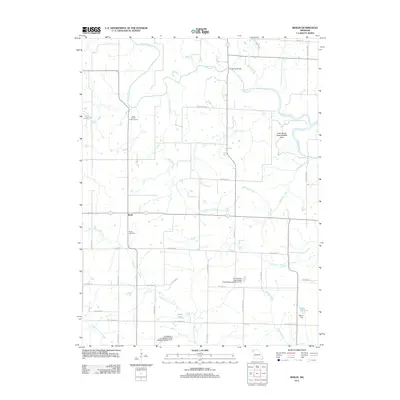
2011 Map of Berlin
USGS Topo · Published 2011About this map
The Grand River meanders across the northern half of this Missouri landscape, creating a river-driven geography that includes the Elam Bend State Wildlife Area and several water-access points like the Andy Denton Public Access. The small settlement of Berlin serves as a central landmark for local genealogists, accompanied by the nearby Berlin Cemetery. This 2011 survey details a rural township where water management is evident through various structures, including the Grindstone-Lost-Muddy Creek Watershed Dam D-22 and the Nance Dam at Lake Mar-Lou. A network of named country roads and crossings, such as Crawford Xing and the Crawford Bridge, provides insight into the local infrastructure connecting family farms and rural homesteads between the East Fork Lost Creek and Jolly Creek.
Find a feature on this map
44 named features on this map. Tap any name to fly to it.
Don’t see what you’re looking for? This feature index may not catch every label — zoom into the map to look around manually.
Map Details
Editions of this 2011 Berlin Map
This is the sole edition of this map. No revisions or reprints were ever made.
Other maps of this area

1923 · Maysville
USGS Topo · 1:62,500

1924 · Winston
USGS Topo · 1:62,500

1925 · Pattonsburg
USGS Topo · 1:62,500

1925 · Maysville
USGS Topo · 1:62,500

1925 · Darlington
USGS Topo · 1:62,500

1944 · Pattonsburg
USGS Topo · 1:62,500

1946 · Pattonsburg
USGS Topo · 1:48,000

1948 · Pattonsburg
USGS Topo · 1:62,500

1950 · Kansas City
USGS Topo · 1:250,000

1950 · Darlington
USGS Topo · 1:62,500