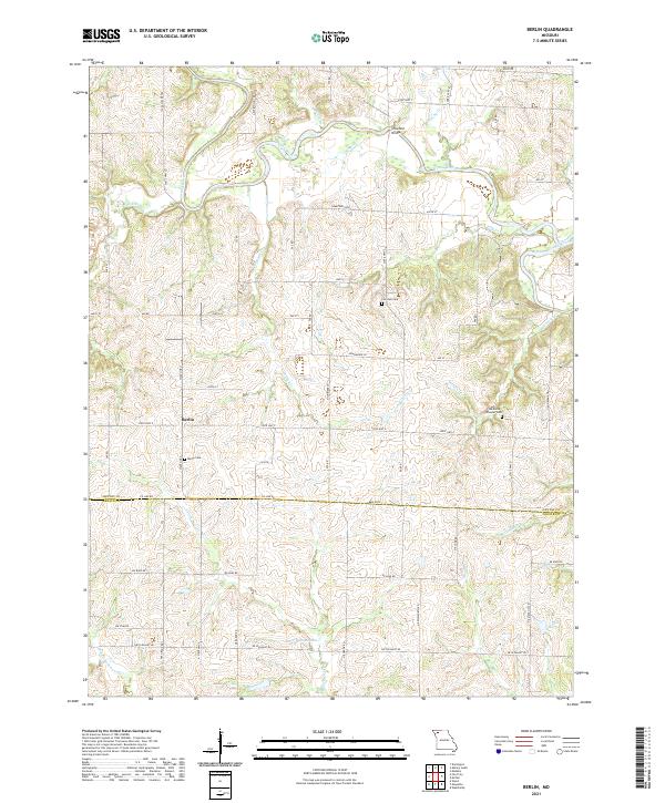
2021 Map of Berlin
USGS Topo · Published 2021About this map
The small settlement of Berlin sits at the junction of State Hwy Z and State Hwy H, serving as a central point in this rural landscape spanning the border of Gentry and DeKalb Counties. The northern half of the region is defined by the winding course of the Grand River, where landmarks like the Crawford Bridge and Crawford Xing facilitate movement across the water. Significant for local family historians, several burial grounds are scattered throughout the countryside, including Berlin Cem, Fairview Cem, and the Hardwick-Wheeler Cem. South of the county line, the terrain transitions into a more intricate network of waterways such as the Middle Fork Lost Cr and E Fork Lost Cr, alongside private impoundments like Jestes Lake and Lake Mar-Lou. This 2021 survey illustrates a modern road network following traditional section lines, overlaid on a deeply dissected drainage basin.
Find a feature on this map
67 named features on this map. Tap any name to fly to it.
Don’t see what you’re looking for? This feature index may not catch every label — zoom into the map to look around manually.
Map Details
Editions of this 2021 Berlin Map
This is the sole edition of this map. No revisions or reprints were ever made.
Other maps of this area

1923 · Maysville
USGS Topo · 1:62,500

1924 · Winston
USGS Topo · 1:62,500

1925 · Pattonsburg
USGS Topo · 1:62,500

1925 · Maysville
USGS Topo · 1:62,500

1925 · Darlington
USGS Topo · 1:62,500

1944 · Pattonsburg
USGS Topo · 1:62,500

1946 · Pattonsburg
USGS Topo · 1:48,000

1948 · Pattonsburg
USGS Topo · 1:62,500

1950 · Kansas City
USGS Topo · 1:250,000

1950 · Darlington
USGS Topo · 1:62,500