2023 Map of Berlin
USGS Topo · Published 2023About this map
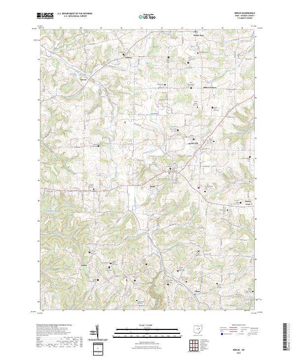
Berlin and the surrounding Holmes County countryside are defined by a high concentration of family-named farm cemeteries, reflecting the area's deep-rooted agricultural and communal heritage. Settlements such as Benton, Fryburg, and Mount Hope are connected by a network of winding roads like Co Rd 77 and Twp Rd 362, which trace the ridges and valleys between waterways. Significant drainage patterns are established by Doughty Creek, Martins Creek, and Middle Fork Sugar Creek, while the southwestern corner features Tranquil Valley Lake. This landscape is heavily punctuated by private burial grounds, including the Noah Beachy Farm Cem, Roy Burkholder Farm Cem, and Ezra Y Miller Farm Cem, offering critical data for genealogists tracing local families across the townships of t10n r6w and t9n r5w. Larger landmarks like Bunker Hill and The Plains provide geographical context to this dense rural patchwork.
Find a feature on this map
138 named features on this map. Tap any name to fly to it.
Don’t see what you’re looking for? This feature index may not catch every label — zoom into the map to look around manually.
Map Details
Editions of this 2023 Berlin Map
This is the sole edition of this map. No revisions or reprints were ever made.