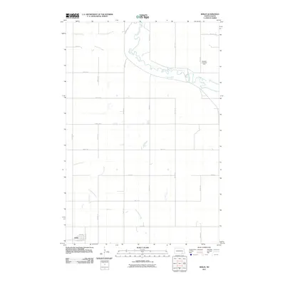
2011 Map of Berlin
USGS Topo · Published 2011About this map
Berlin occupies the southwestern corner of this LaMoure County landscape, serving as a concentrated point of settlement amidst a vast agricultural grid. The town's layout is defined by streets such as Elevator Ave, 1st Ave, and 3rd Ave, hinting at the town's historical reliance on the surrounding grain production. To the north, the winding James River meanders across the territory, its flow regulated by the Seefeldt-Limesand Dam. This waterway, along with its tributaries Bone Hill Creek and Cottonwood Creek, breaks the rigid geometry of the section lines and county roads. The map illustrates a modern rural infrastructure where named routes like County Rd 62 and County Rd 34 facilitate the movement of goods through the northern plains.
Find a feature on this map
25 named features on this map. Tap any name to fly to it.
Don’t see what you’re looking for? This feature index may not catch every label — zoom into the map to look around manually.
Map Details
Editions of this 2011 Berlin Map
This is the sole edition of this map. No revisions or reprints were ever made.
Other maps of this area

1894 · La Moure
USGS Topo · 1:62,500

1895 · Lamoure
USGS Topo · 1:125,000

1896 · Jamestown
USGS Topo · 1:125,000

1896 · Edgeley
USGS Topo · 1:125,000

1897 · Eckelson
USGS Topo · 1:125,000

1918 · La Moure
USGS Topo · 1:125,000

1925 · Edgeley
USGS Topo · 1:125,000

1952 · Dickey
USGS Topo · 1:24,000

1952 · Grand Rapids
USGS Topo · 1:24,000

1953 · Jamestown
USGS Topo · 1:250,000