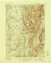
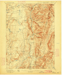
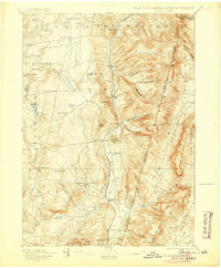
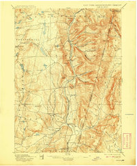
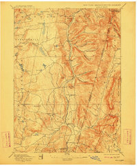
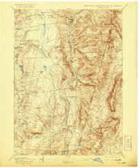
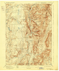
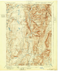
1898 Map of Berlin
USGS Topo · Published 1944About this map
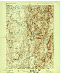
Rutland Railroad tracks bisect the valley of the Little Hoosic River on this reconnaissance survey, which documents the mountainous borderlands where New York meets Massachusetts and Vermont. The landscape is defined by deep topographic cuts like Barber Hollow and Mattison Hollow, with numerous small settlements clustered near water sources and rail access. Genealogists can locate family-named features such as George Allen Hollow and McMaster Hollow, while researchers of the regional transport network will find the Station at North Stephentown and the strategic Petersburg Pass. From the heights of Berlin Mtn to the southern reach of Wyomanock, the map illustrates a late 19th-century economy of isolated hamlets like Garfield and Stephentown Center connected by a web of creeks including Tuckawasick Creek and Kinderhook Creek.
Find a feature on this map
77 named features on this map. Tap any name to fly to it.
Don’t see what you’re looking for? This feature index may not catch every label — zoom into the map to look around manually.
Map Details
Editions of this 1898 Berlin Map
10 editions found

Other maps of this area

1886 · Greylock
USGS Topo · 1:62,500

1886 · Becket
USGS Topo · 1:62,500

1888 · Becket
USGS Topo · 1:62,500

1888 · Berlin
USGS Topo · 1:62,500

1888 · Pittsfield
USGS Topo · 1:62,500

1890 · Pittsfield
USGS Topo · 1:62,500

1890 · Berlin
USGS Topo · 1:62,500

1891 · Greylock
USGS Topo · 1:62,500

1893 · Cohoes
USGS Topo · 1:62,500

1893 · Troy
USGS Topo · 1:62,500