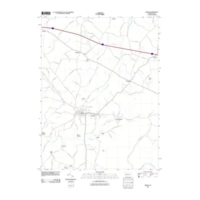
2010 Map of Berlin
USGS Topo · Published 2010About this map
Berlin serves as the central hub of this Somerset County landscape, where the town's dense residential grid transitions into the sprawling agricultural and industrial reaches of the surrounding highlands. The geography is defined by the headwaters of the Stonycreek River and Buffalo Creek, which carve through the terrain near the ridge line of Mountain Ridge. Evidence of the region’s long-standing connection to resource extraction is clear through the presence of the Shipley Brothers Mine near Roxbury and the Salco Mines located further south near Salco. Smaller historic clusters such as East Liberty, East End, and Vietersburg surround the main borough, while the rural character is maintained by local landmarks like the Hillcrest Grange and the Pike Cemetery. The map also captures the local transportation network, ranging from the high-speed corridors of the interstate to the localized rail connections at Niver Junction.
Find a feature on this map
88 named features on this map. Tap any name to fly to it.
Don’t see what you’re looking for? This feature index may not catch every label — zoom into the map to look around manually.
Map Details
Editions of this 2010 Berlin Map
This is the sole edition of this map. No revisions or reprints were ever made.
Other maps of this area

1913 · Somerset
USGS Topo · 1:62,500

1914 · Windber
USGS Topo · 1:62,500

1915 · Somerset
USGS Topo · 1:62,500

1916 · Windber
USGS Topo · 1:62,500

1921 · Meyersdale
USGS Topo · 1:62,500

1923 · Berlin
USGS Topo · 1:48,000

1929 · Berlin
USGS Topo · 1:62,500

1939 · Meyersdale
USGS Topo · 1:62,500

1944 · Somerset
USGS Topo · 1:62,500

1944 · Windber
USGS Topo · 1:62,500
Featured Places
- Berlin, PA
- Stonycreek Township, PA
- Somerset Township, PA
- Northampton Township, PA
- Downey, Stonycreek Township