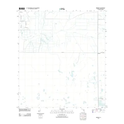
2012 Map of Bermont
USGS Topo · Published 2012About this map
Bermont sits at the intersection of rural transit and natural drainage in this southwest Florida landscape. The settlement is defined by its proximity to several significant waterways, including Cypress Slough, Myrtle Slough, and the winding course of Shell Creek. These features illustrate the characteristic low-lying hydrology of the region, where seasonal water flow dictates land use and road placement. The eastern edge of the quadrangle is anchored by the Bermont Lookout Tower, a functional landmark in the flat topography. To the south, the Fred Babcock Airport serves as a modern touchpoint in an otherwise sparsely populated area. Development is concentrated along a network of named corridors such as Prairie Creek Blvd and Bermont Rd, showing how residential surveying began to interface with the surrounding wetlands in the early twenty-first century.
Find a feature on this map
15 named features on this map. Tap any name to fly to it.
Don’t see what you’re looking for? This feature index may not catch every label — zoom into the map to look around manually.
Map Details
Editions of this 2012 Bermont Map
This is the sole edition of this map. No revisions or reprints were ever made.
Other maps of this area

1956 · Arcadia SE
USGS Topo · 1:24,000

1956 · Telegraph Swamp
USGS Topo · 1:24,000

1956 · Cleveland
USGS Topo · 1:24,000

1956 · Telegraph Swamp NW
USGS Topo · 1:24,000

1956 · Ft. Ogden
USGS Topo · 1:24,000

1956 · Long Island Marsh SW
USGS Topo · 1:24,000

1956 · Bermont
USGS Topo · 1:24,000

1956 · West Palm Beach
USGS Topo · 1:250,000

1956 · Fort Pierce
USGS Topo · 1:250,000

1957 · West Palm Beach
USGS Topo · 1:250,000