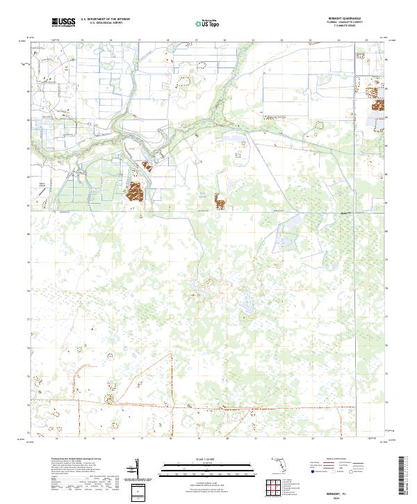
2024 Map of Bermont
USGS Topo · Published 2024About this map
Shell Creek meanders across this landscape, defining a region where modern rural developments meet expansive conservation lands in Charlotte County. The northern reaches show a network of residential corridors including Prairie Creek Blvd and Acorn Ranch Rd, while the southern half is dominated by the Babcock Webb Wildlife Management Area Trail. This alignment shows the deliberate preservation of Florida's drainage systems, as water moves through Cypress Slough and Myrtle Slough toward the coast.
Find a feature on this map
25 named features on this map. Tap any name to fly to it.
Don’t see what you’re looking for? This feature index may not catch every label — zoom into the map to look around manually.
Map Details
Editions of this 2024 Bermont Map
This is the sole edition of this map. No revisions or reprints were ever made.
Other maps of this area

1956 · Arcadia SE
USGS Topo · 1:24,000

1956 · Telegraph Swamp
USGS Topo · 1:24,000

1956 · Cleveland
USGS Topo · 1:24,000

1956 · Telegraph Swamp NW
USGS Topo · 1:24,000

1956 · Ft. Ogden
USGS Topo · 1:24,000

1956 · Long Island Marsh SW
USGS Topo · 1:24,000

1956 · Bermont
USGS Topo · 1:24,000

1956 · West Palm Beach
USGS Topo · 1:250,000

1956 · Fort Pierce
USGS Topo · 1:250,000

1957 · West Palm Beach
USGS Topo · 1:250,000