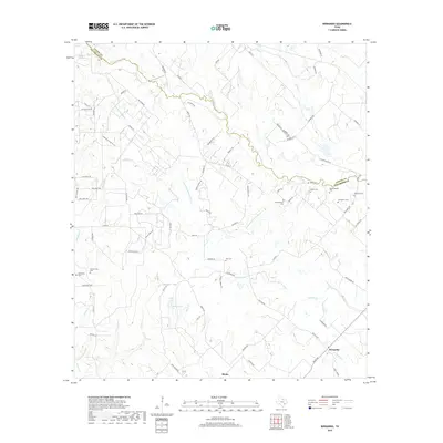
2019 Map of Bernardo
USGS Topo · Published 2019About this map
The San Bernard River and its meandering tributary, the Little San Bernard River, define the rural landscape along the boundary of Austin and Colorado Counties. This interior portion of the Texas coastal plain is characterized by dispersed family settlements and an exceptionally high density of small family burial grounds. Notable sites such as Bretschneider Cem, Gaedecker Cem, and Reichardt Cem are clustered near the unincorporated community of Bernardo, reflecting a deep lineage of local landownership and private interment practices. To the southwest, the community of Mentz serves as another focal point for this agrarian region. The drainage patterns of Schmitt Cr, Piney Cr, and Brushy Cr illustrate the low-lying, well-watered nature of the terrain, where land use is dictated by the proximity to Bailey Lake and various smaller creeks.
Find a feature on this map
84 named features on this map. Tap any name to fly to it.
Don’t see what you’re looking for? This feature index may not catch every label — zoom into the map to look around manually.
Map Details
Editions of this 2019 Bernardo Map
This is the sole edition of this map. No revisions or reprints were ever made.
Other maps of this area

1919 · Fayettsville
USGS Topo · 1:62,500

1953 · Seguin
USGS Topo · 1:250,000

1956 · Bellville
USGS Topo · 1:62,500

1956 · Glidden
USGS Topo · 1:62,500

1957 · Eagle Lake
USGS Topo · 1:62,500

1957 · Columbus
USGS Topo · 1:24,000

1958 · Seguin
USGS Topo · 1:250,000

1958 · Industry
USGS Topo · 1:24,000

1958 · Frelsburg
USGS Topo · 1:24,000

1958 · Bernardo
USGS Topo · 1:24,000