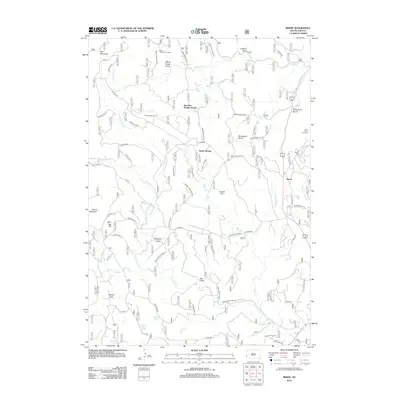
2012 Map of Berne
USGS Topo · Published 2012About this map
Crazy Horse Carvings dominate the eastern landscape of this Black Hills survey, representing a significant period of monumental artistry and local history. The map detail highlights the complex hydrology of the region, where the N Fork French Cr and Middle Fork French Cr converge into French Cr. Settlement patterns are sparse, defined primarily by service points like the Junction Ranger Station and small clusters such as Berne.
Find a feature on this map
46 named features on this map. Tap any name to fly to it.
Don’t see what you’re looking for? This feature index may not catch every label — zoom into the map to look around manually.
Map Details
Editions of this 2012 Berne Map
This is the sole edition of this map. No revisions or reprints were ever made.
Other maps of this area

1896 · Harney Peak
USGS Topo · 1:125,000

1901 · Harney Peak
USGS Topo · 1:125,000

1954 · Fourmile
USGS Topo · 1:24,000

1954 · Custer
USGS Topo · 1:24,000

1954 · Hill City
USGS Topo · 1:24,000

1954 · Berne
USGS Topo · 1:24,000

1955 · Jewel Cave
USGS Topo · 1:24,000

1955 · Signal Hill
USGS Topo · 1:24,000
1955 · Cicero Peak
USGS Topo · 1:24,000

1955 · Hot Springs
USGS Topo · 1:250,000