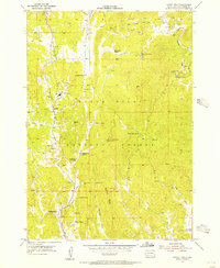
1955 Map of Cicero Peak
USGS Topo · Published 1956About this map
The State Sanatorium and nearby Sanator settlement occupy a prominent position within the Black Hills National Forest during the mid-1950s. This survey, conducted with cooperation from the United States Atomic Energy Commission, reflects a landscape defined by ranching and small-scale mining activity. Family names are etched into the terrain through sites like McCurran Ranch, Winters Ranch, and the Sutherland Ranch near Sutherland Spring.
Find a feature on this map
43 named features on this map. Tap any name to fly to it.
Don’t see what you’re looking for? This feature index may not catch every label — zoom into the map to look around manually.
Map Details
Editions of this 1955 Cicero Peak Map
3 editions found
Other maps of this area

1894 · Hermosa
USGS Topo · 1:125,000

1896 · Harney Peak
USGS Topo · 1:125,000

1901 · Hermosa
USGS Topo · 1:125,000

1901 · Harney Peak
USGS Topo · 1:125,000

1954 · Iron Mountain
USGS Topo · 1:24,000

1954 · Fourmile
USGS Topo · 1:24,000

1954 · Custer
USGS Topo · 1:24,000

1954 · Berne
USGS Topo · 1:24,000

1954 · Mount Rushmore
USGS Topo · 1:62,500

1955 · Mt. Coolidge
USGS Topo · 1:24,000