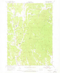
1955 Map of Cicero Peak
USGS Topo · Published 1973About this map
Chicago Burlington And Quincy tracks follow the narrow valley of Beaver Creek through this mid-century survey of the Black Hills. The landscape is defined by its institutional and extractive history, centered on the extensive State Sanatorium and a cluster of mines scattered across the forested slopes of Cicero Peak. Near the rail line, the rural landscape is anchored by educational and agricultural markers like Evergreen Sch, Mayo Sch, and several family-held tracts including Winters Ranch and Sutherland Ranch. This 1955 field check, published by the Geological Survey and the Atomic Energy Commission, highlights a transition in the local economy as traditional ranching and timber coexist with specialized mining operations like the Rose Quartz Mine and Beecher No 2 Mines. The rugged topography, marked by Bowman Ridge and the Lake of the Pines, illustrates the isolation of these high-country settlements during the post-war era.
Find a feature on this map
40 named features on this map. Tap any name to fly to it.
Don’t see what you’re looking for? This feature index may not catch every label — zoom into the map to look around manually.
Map Details
Editions of this 1955 Cicero Peak Map
3 editions found
Other maps of this area

1894 · Hermosa
USGS Topo · 1:125,000

1896 · Harney Peak
USGS Topo · 1:125,000

1901 · Hermosa
USGS Topo · 1:125,000

1901 · Harney Peak
USGS Topo · 1:125,000

1954 · Iron Mountain
USGS Topo · 1:24,000

1954 · Fourmile
USGS Topo · 1:24,000

1954 · Custer
USGS Topo · 1:24,000

1954 · Berne
USGS Topo · 1:24,000

1954 · Mount Rushmore
USGS Topo · 1:62,500

1955 · Mt. Coolidge
USGS Topo · 1:24,000